CH 16 · UK & Irish Sea
VHF Radio Assistant
Talk for me on the water
Mic fright? Stammer under pressure? Read the script calmly yourself — or tap once and let it call for you, word for word.
Every call is scripted and ready before you press transmit — marina, harbour master, lock, Coastguard, VTS, vessels, or a buddy boat — with the right channel, your nearest marker or position, and both vessel names filled in for wherever you are. Say it yourself, calm and word-perfect, or let it speak for you, clearly, every time. No fumbling for words. No dead air. No guessing the channel.
Built at the helm for real UK and Irish Sea sailing, alongside live AIS tracking, offline charts, and collision alerts.
In development · not yet available
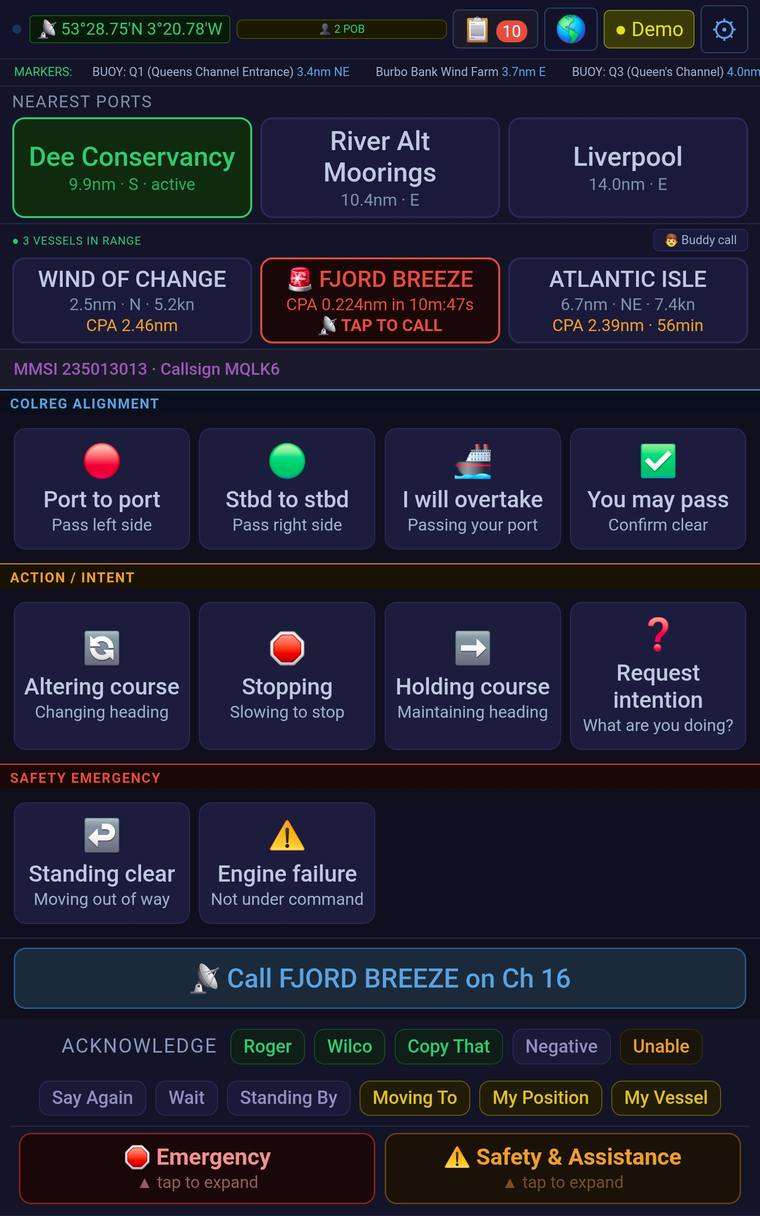
Sees the danger before you do
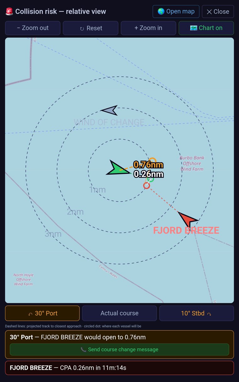
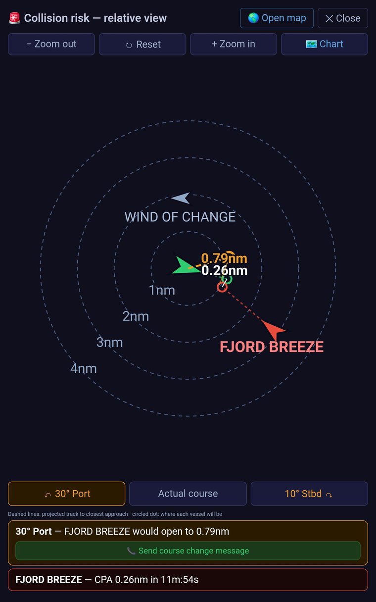
Flags a close-quarters vessel in red, with the COLREG call ready to go.
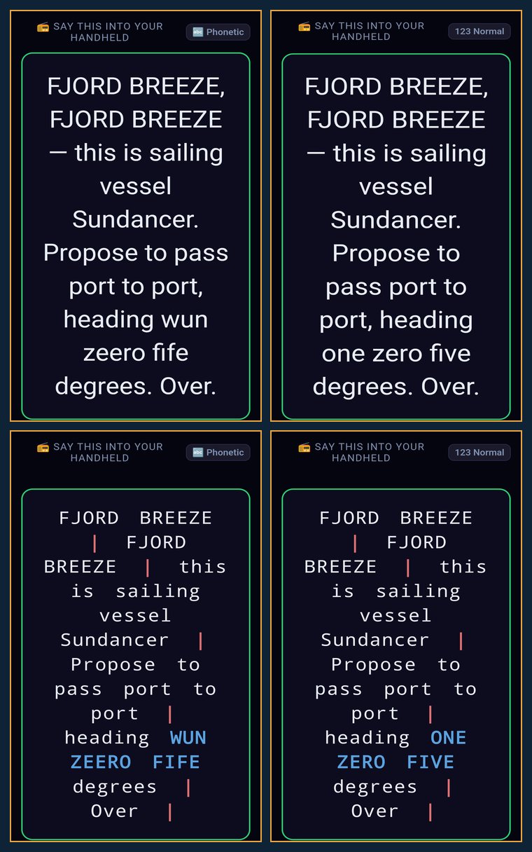
"FJORD BREEZE, FJORD BREEZE, this is sailing vessel SUNDANCER. I am half a mile north-east of buoy Q1, my heading is 195 degrees at 5.5 knots. I intend to pass port to port. Over."
Vessel name, nearest marker, heading and speed — filled in automatically, every time.
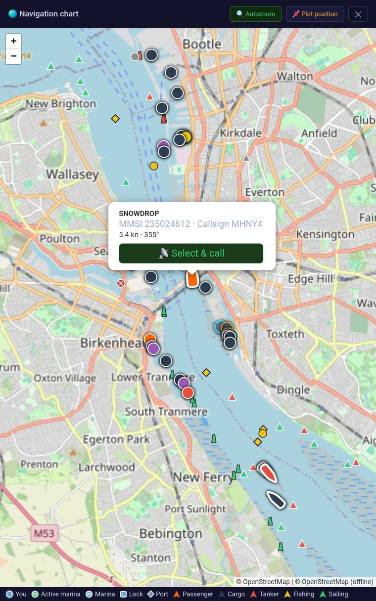
Not a mockup — real traffic, tracked live
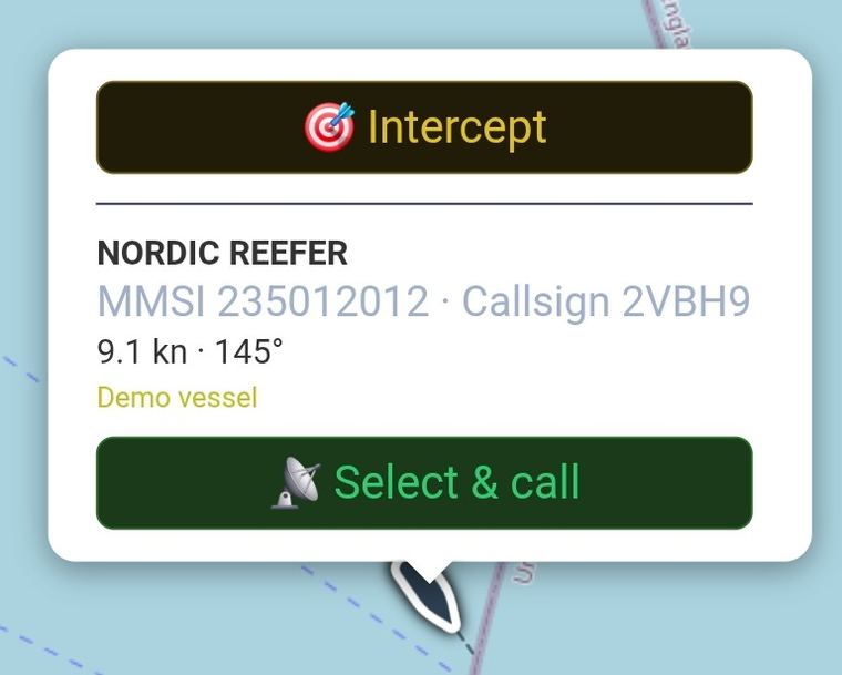
The tablet connected wirelessly to the vessel's AIS receiver from the marina — every vessel it picked up on the Mersey, tap one to call it.
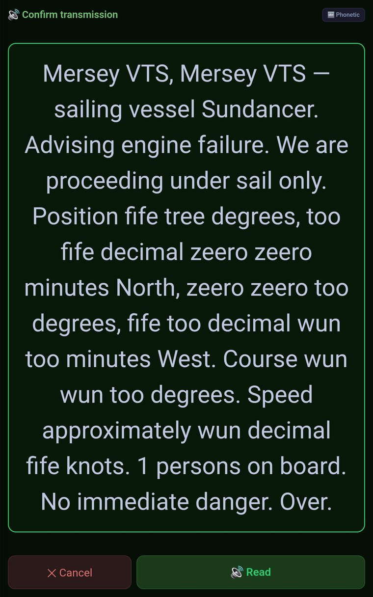
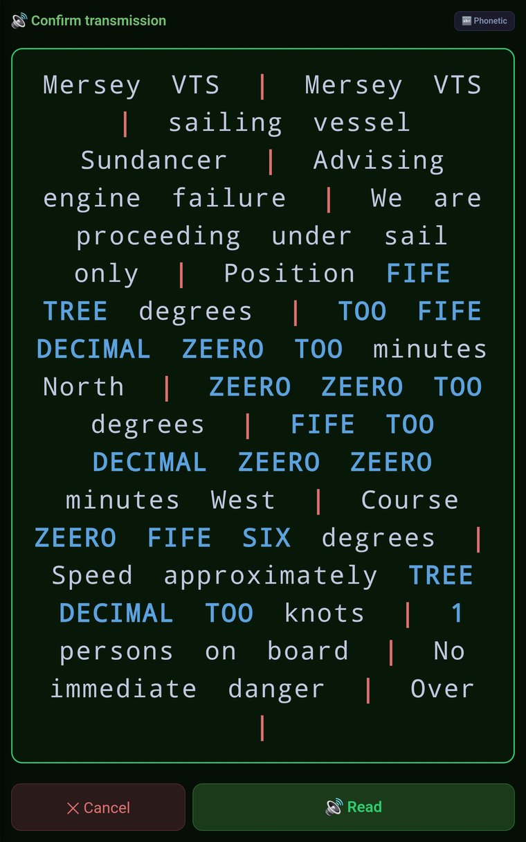
Engine failure? It already knows what to say
One tap on "Engine failure" and the call is written — position, course, speed and crew on board, all filled in automatically. Read it Standard, or switch to Paced for a steadier, word-by-word rhythm.
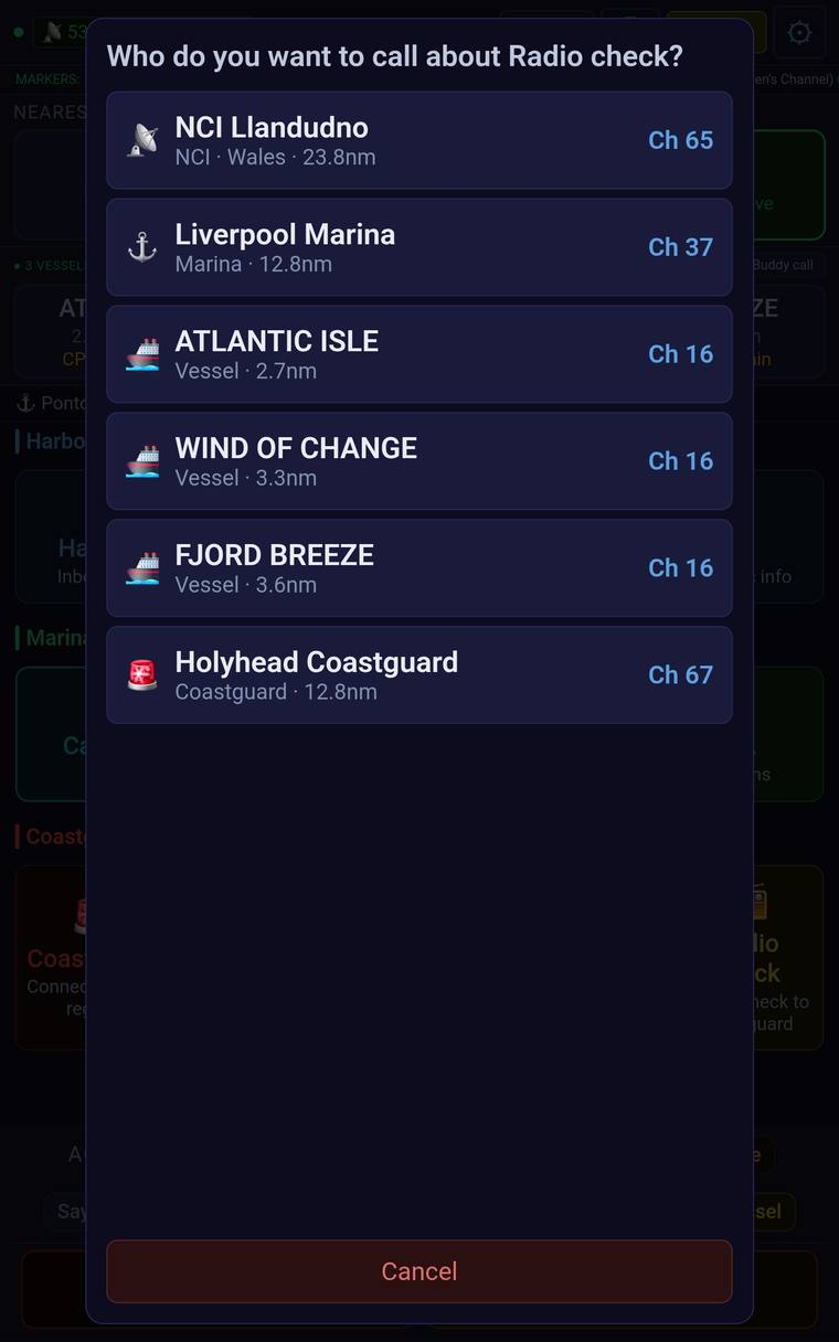
Knows exactly who to call
A marina button calls the marina, a VTS button calls VTS — or set a button like Radio Check to offer several options, in priority order, like this one.
Update once. Stay in sync everywhere.
Duplicate a device's whole setup in one go — marinas, channels, custom buttons and all — or share a live intercept course, so whoever's on the second screen sees the same target, the same heading, the same ETA. Press send on one device, receive on the other, done.
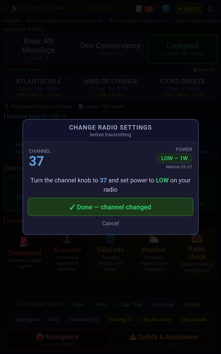
Never guess the channel again
Tells you exactly which channel and power to set before you transmit.
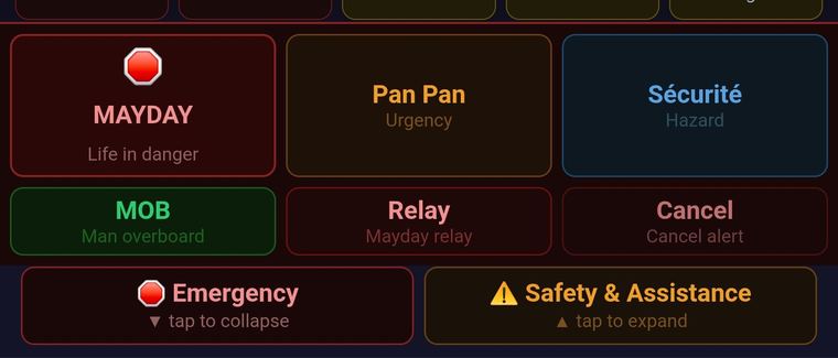
One tap, and it's already written
MAYDAY, Pan Pan, Sécurité, MOB — every emergency call, pre-filled with your vessel name, position and lat/lng, ready before your hands even shake.
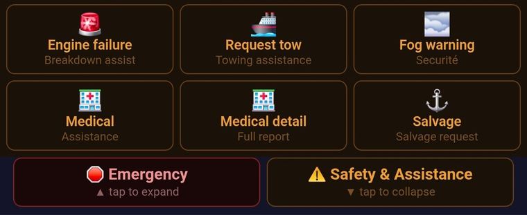
For everything short of a Mayday
Engine failure, request a tow, call for medical help — the non-emergency calls that still need to go out clearly, one tap away.
What it does
Everything you need to make the call
Scenario call buttons
Marina, harbour master, lock, Coastguard, VTS, vessels, and buddy calls — each with the correct channel, nearest marker or position, and vessel names filled in automatically for wherever you are, plus its own script and reply suggestions.
Read it yourself, or let it speak
Every script is on screen, calm and ready to read — or tap once and text-to-speech reads it aloud clearly, ready to hold up to your radio's mic, key, and send, with a hard stop you can trigger at any time.
Voice Warmup
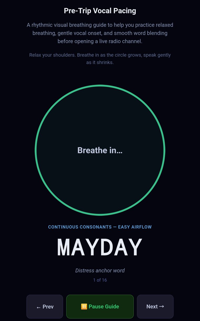
Open Voice Warmup in Settings to settle your breathing and pacing before you sail — then toggle the paced display on for real calls too, whenever you want that steadier rhythm.
Practise for real, from your armchair
Demo Mode populates the app with realistic vessel traffic, marinas and a simulated position — press any reply button and get a proper response back, just as if it were real. Nothing is actually transmitted.
Live AIS & collision alerts
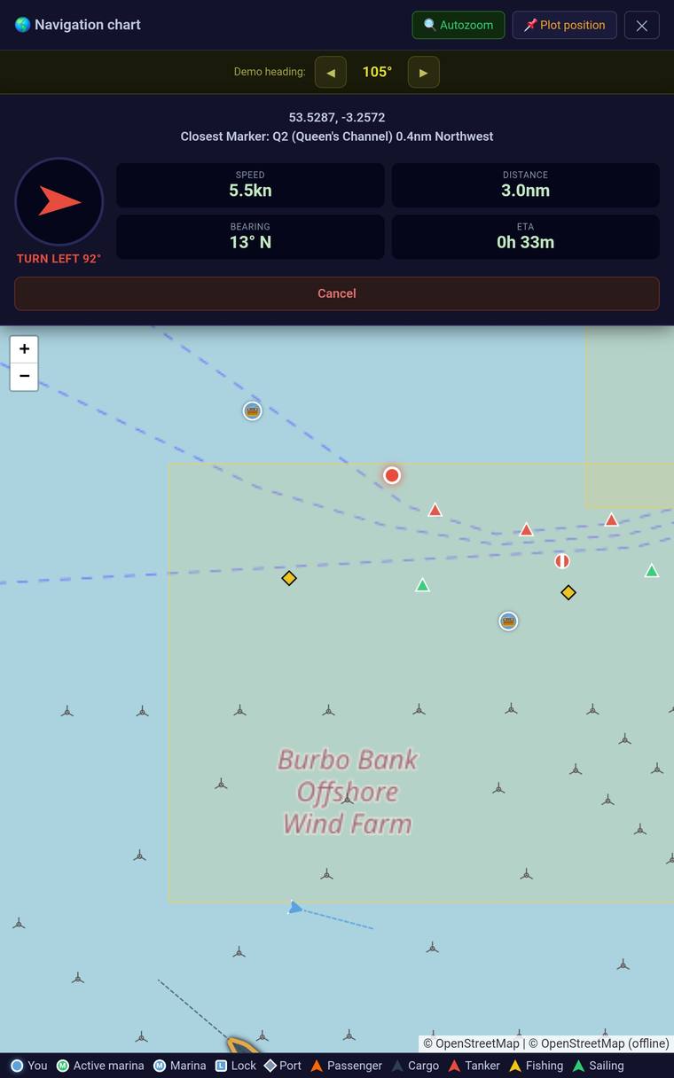
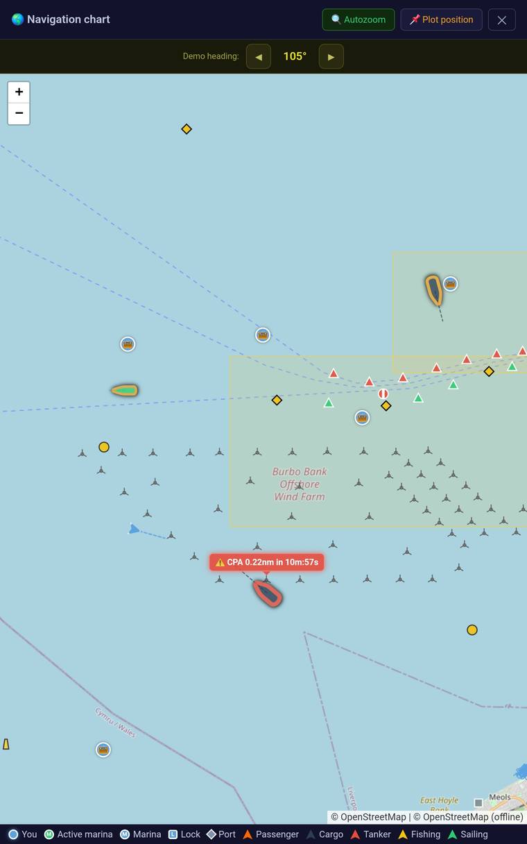
Live AIS/GPS tracking with CPA/TCPA collision alerts, so you're still watching traffic while you're on the radio.
Vessel interception
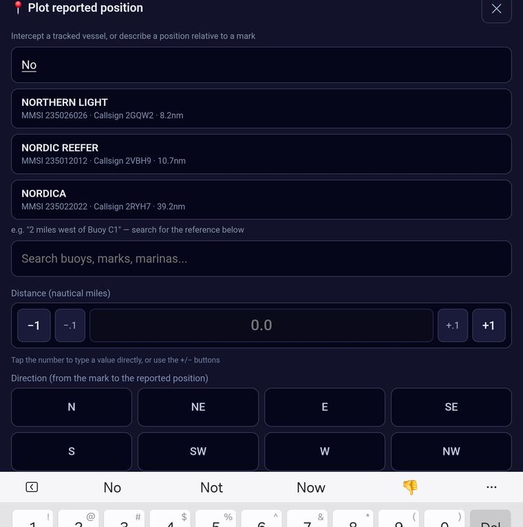
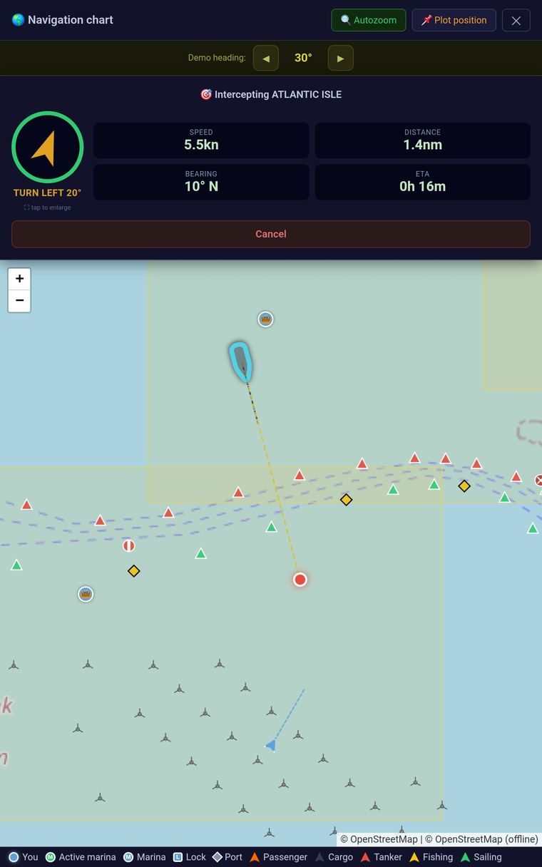
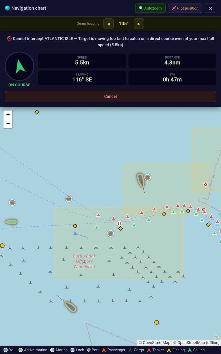
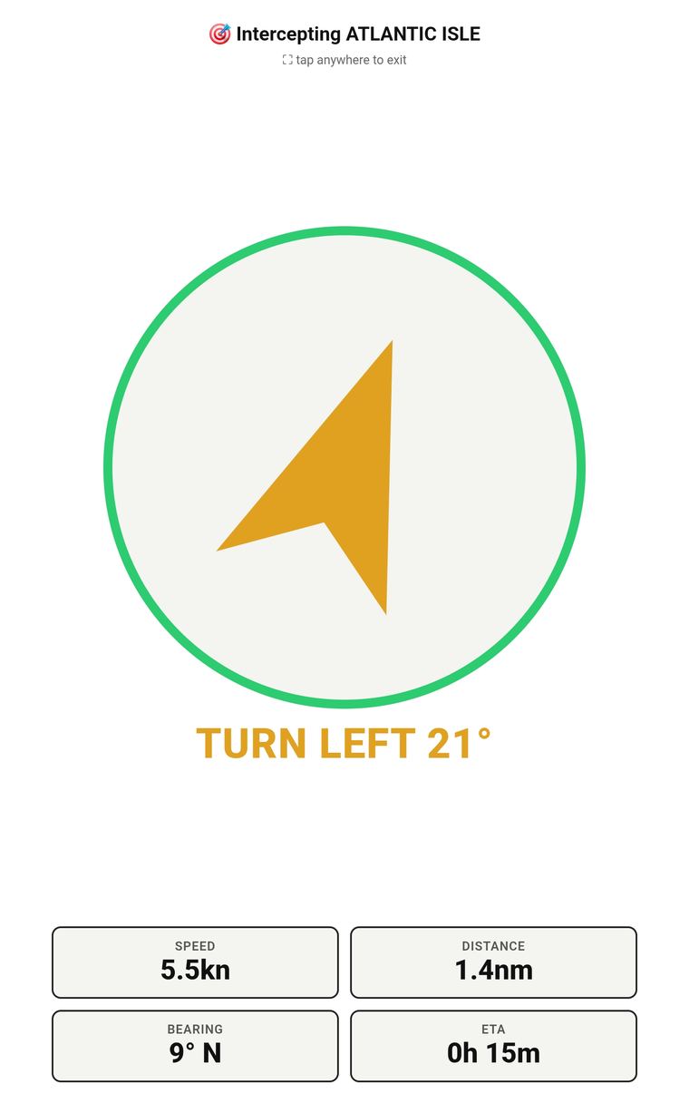
Engine trouble and their AIS is still on? Tap them on the chart or search by name, MMSI or callsign, and it plots a live intercept course — not to where they are, but to where you'll actually meet, recalculated as both your speeds change. Can't catch them on a direct course? It tells you straight away, before you waste fuel finding out yourself.
Offline nautical charts
Offline charts for UK and Irish waters, with channel names pulled from real seamark data — no signal needed.
AIS-SRM digital terminal
Turns your tablet into a passive maritime safety receiver — decodes Type 14 broadcast alerts from any nearby vessel and Type 12 messages addressed to your MMSI, then pre-fills a response script, entirely offline.
Single-handed MOB rescue
If you're sailing solo and go overboard, the boat recognises it's unmanned and automatically broadcasts a VHF Mayday with your beacon's position — extending its approximate 2nm range out to your vessel's own VHF radio range, typically up to 15nm.
Map marker finder
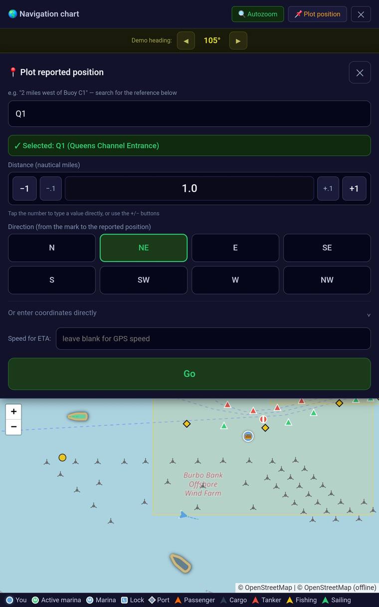
Search the chart for buoys, marks and other charted features, and jump straight to them on the map.
Custom buttons
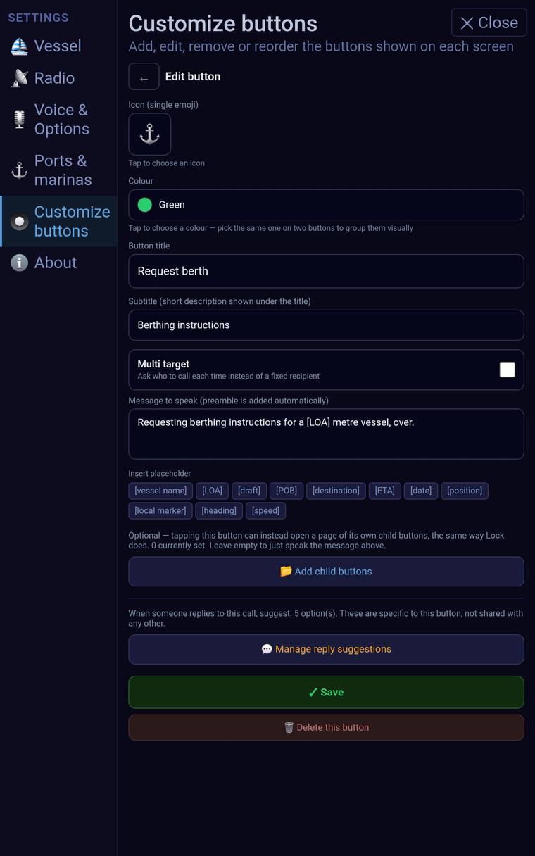
Add your own call buttons for any scenario you need, alongside the built-in ones — set the icon, label and script yourself.
Custom quick replies
Each button comes with its own set of suggested replies matched to that call, and you can edit them or add your own.
How it works
Four steps, calm every time
Pick the scenario
Marina, harbour master, Coastguard, VTS, a lock, or a buddy boat.
Check the wording
An editable, COLREG-aligned script is ready before you press send.
Send it on channel
Tap send and it's read aloud over your radio, clearly.
Stay aware
Live AIS keeps watching CPA/TCPA risk in the background while you call.
Early look
Single-handed MOB
Single-handed, and no one left to call it in
Solo sailor overboard — no one left aboard to make the call. The boat recognises it's now unmanned and transmits an automatic VHF Mayday with the beacon's coordinates, reaching boats and stations up to 15nm away, far past the beacon's own approximate 2nm range. Search and Rescue or the Coastguard stay in control throughout, and can silence the loop remotely to free the channel.
Home screen
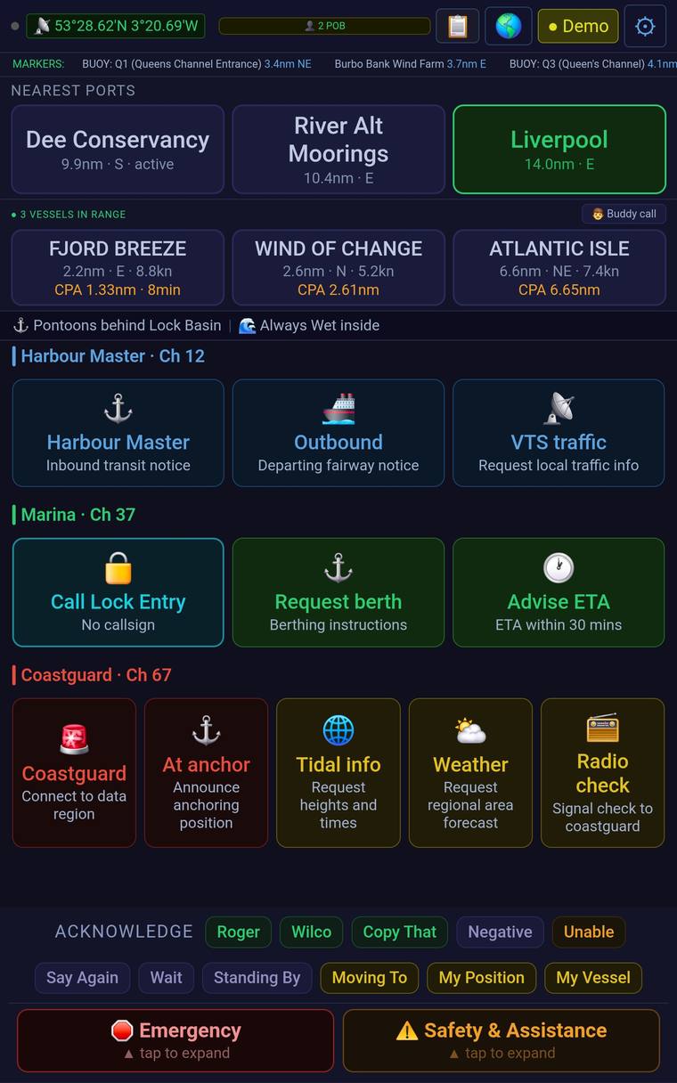
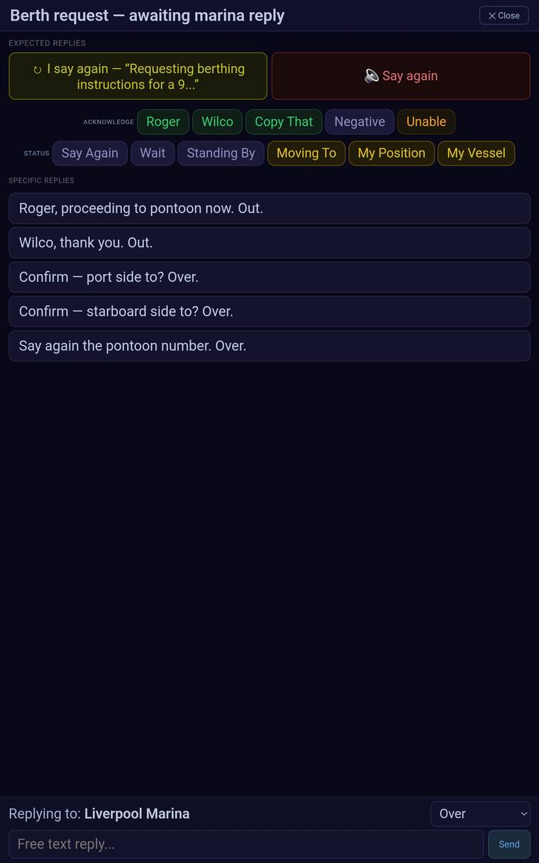
Marker & position lookup and Vessel interception
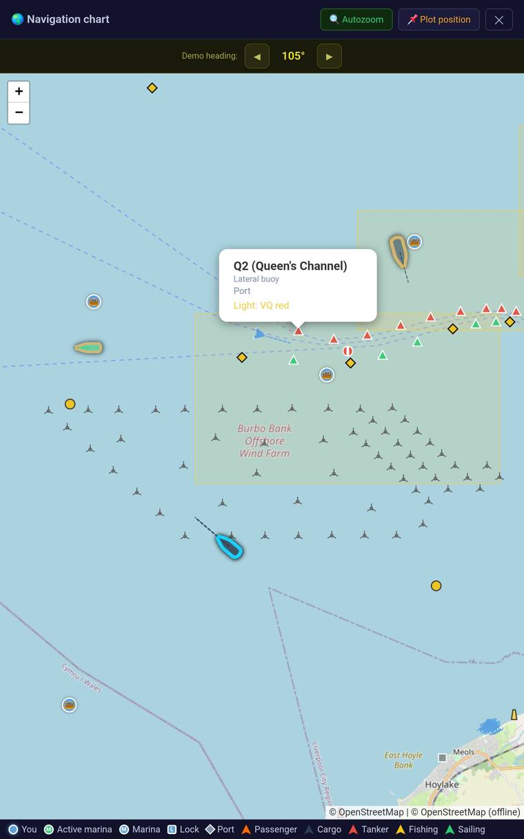
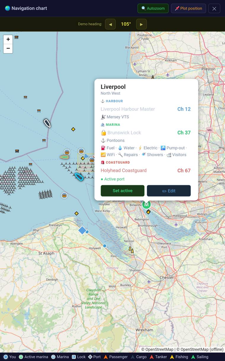
Collision alerts (CPA)
Settings
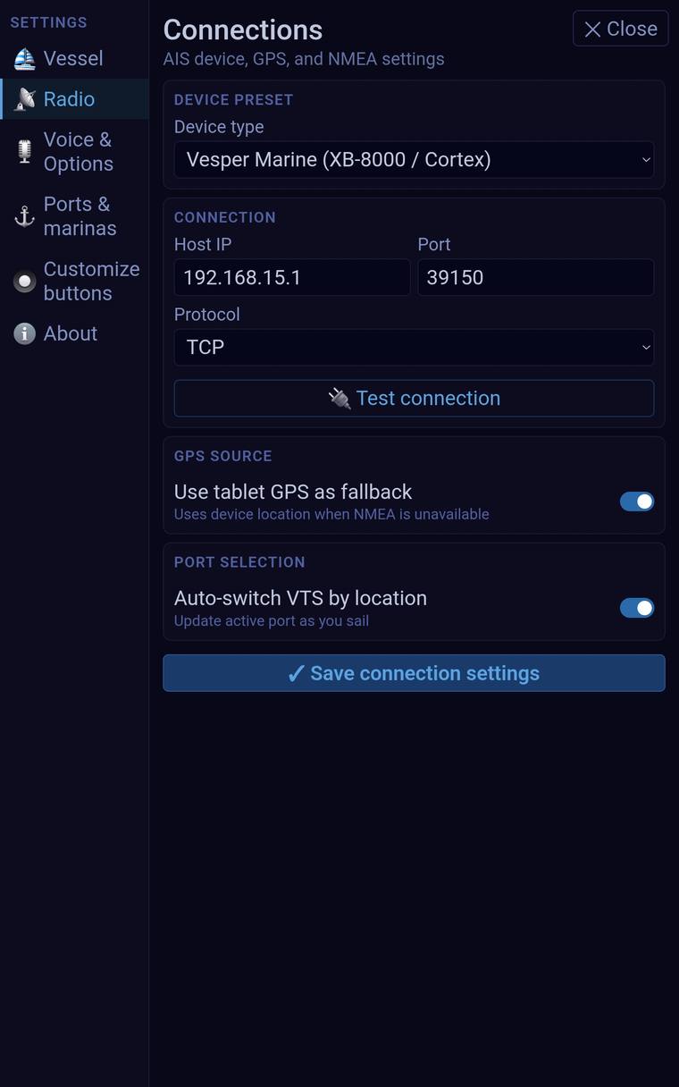
Real screenshots, taken mid-development — some screens are still changing.
Hardware
One cable, for the moment you can't press it yourself
No new transmitter, no new call sign. Everyday calls just need the tablet's speaker held to your radio's mic. The one place hardware comes in is the Single-Handed MOB relay — a Digirig Mobile USB audio interface wired to your existing VHF, so the app can key PTT automatically when there's no one aboard to do it.
Currently tested with a Standard Horizon HX891BT handheld. A fixed-mount option is also being explored for the chart table.
Get in touch
Want to hear when it's ready?
Leave your email and you'll get one message when it launches. No spam.
Prefer email? Get in touch directly
Development notice: VHF Radio Assistant is currently in active development and is not yet available for public deployment. All preview features, scripts, and interface designs are subject to change. This software is intended strictly as a secondary training and preparation aid and does not constitute official maritime safety or navigation advice.